
北ノ俣岳 topographic map
Interactive map
Click on the map to display elevation.
About this map
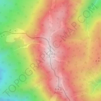
Name: 北ノ俣岳 topographic map, elevation, terrain.
Location: 北ノ俣岳, 富山市, 富山県, 日本 (36.42101 137.51234 36.42111 137.51244)
Average elevation: 2,352 m
Minimum elevation: 1,926 m
Maximum elevation: 2,655 m
Other topographic maps
Click on a map to view its topography, its elevation and its terrain.