
帯広市 topographic map
Interactive map
Click on the map to display elevation.
About this map
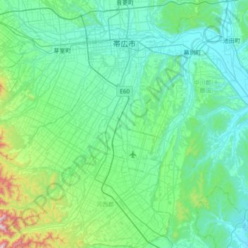
Name: 帯広市 topographic map, elevation, terrain.
Location: 帯広市, 十勝総合振興局, 北海道, 日本 (42.61484 142.68685 42.95285 143.26830)
Average elevation: 162 m
Minimum elevation: 2 m
Maximum elevation: 1,209 m
帯広市の市街地形成は1892年(明治25年)の北海道庁による殖民区画に基づいている。
Other topographic maps
Click on a map to view its topography, its elevation and its terrain.