
藤野6条4 topographic map
Interactive map
Click on the map to display elevation.
About this map
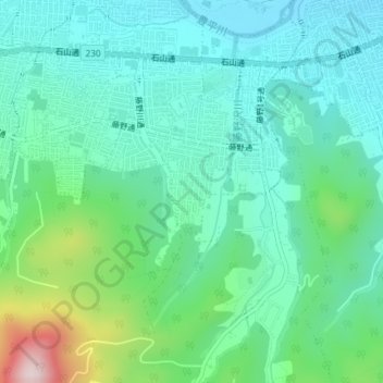
Name: 藤野6条4 topographic map, elevation, terrain.
Location: 藤野6条4, 南区, 札幌市, 石狩振興局, 北海道, 日本 (42.94964 141.30090 42.95438 141.30638)
Average elevation: 215 m
Minimum elevation: 111 m
Maximum elevation: 556 m
Other topographic maps
Click on a map to view its topography, its elevation and its terrain.