
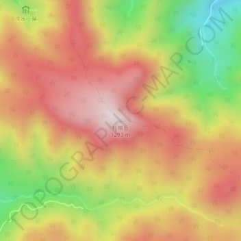
札幌岳 topographic map
Interactive map
Click on the map to display elevation.
About this map
Name: 札幌岳 topographic map, elevation, terrain.
Location: 札幌岳, 札幌市, 石狩振興局, 北海道, 日本 (42.90017 141.20051 42.90027 141.20061)
Average elevation: 976 m
Minimum elevation: 583 m
Maximum elevation: 1,269 m
札幌岳(さっぽろだけ)は支笏洞爺国立公園内に含まれ、北海道石狩振興局札幌市にある標高1,293mの火山である。
Other topographic maps
Click on a map to view its topography, its elevation and its terrain.