
東区 topographic map
Interactive map
Click on the map to display elevation.
About this map
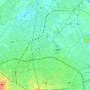
Name: 東区 topographic map, elevation, terrain.
Location: 東区, 札幌市, 石狩振興局, 北海道, 日本 (43.06852 141.34315 43.16700 141.45726)
Average elevation: 8 m
Minimum elevation: -1 m
Maximum elevation: 35 m
区域は東西9.3 km、南北11.0 kmある。中央区とは函館本線、北区とは創成川と旧篠路村境界、白石区とは、豊平川と旧豊平川、江別市とは豊平川と石狩川、石狩郡当別町とは当別川と石狩川を挟んで接している。地形は平坦で山がなく、モエレ沼公園にある人工の山「モエレ山」が唯一の山となっている。地質は鉄東地区の一部を除いて埴土や泥炭で形成している。
Other topographic maps
Click on a map to view its topography, its elevation and its terrain.