
川沿7条4 topographic map
Interactive map
Click on the map to display elevation.
About this map
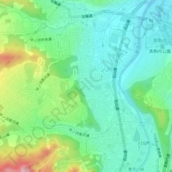
Name: 川沿7条4 topographic map, elevation, terrain.
Location: 川沿7条4, 南区, 札幌市, 石狩振興局, 北海道, 日本 (42.98778 141.32662 42.98988 141.32981)
Average elevation: 123 m
Minimum elevation: 60 m
Maximum elevation: 283 m
Other topographic maps
Click on a map to view its topography, its elevation and its terrain.