
明和 topographic map
Interactive map
Click on the map to display elevation.
About this map
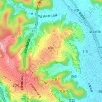
Name: 明和 topographic map, elevation, terrain.
Location: 明和, 鹿児島市, 鹿児島県, 892-8677, 日本 (31.59467 130.51512 31.60974 130.53317)
Average elevation: 57 m
Minimum elevation: 3 m
Maximum elevation: 140 m
Other topographic maps
Click on a map to view its topography, its elevation and its terrain.