
ja:牟礼岡 topographic map
Interactive map
Click on the map to display elevation.
About this map
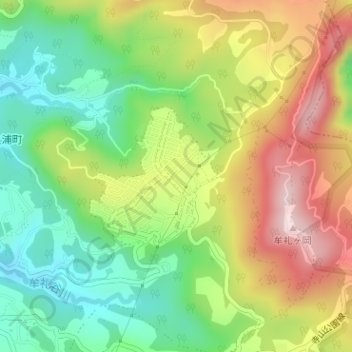
Name: ja:牟礼岡 topographic map, elevation, terrain.
Location: ja:牟礼岡, 鹿児島市, 鹿児島県, 892-8677, 日本 (31.66918 130.57880 31.67985 130.59045)
Average elevation: 330 m
Minimum elevation: 173 m
Maximum elevation: 534 m
Other topographic maps
Click on a map to view its topography, its elevation and its terrain.