
福山町 topographic map
Interactive map
Click on the map to display elevation.
About this map
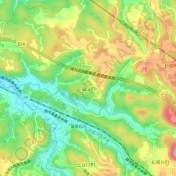
Name: 福山町 topographic map, elevation, terrain.
Location: 福山町, 鹿児島市, 鹿児島県, 892-8677, 日本 (31.59725 130.42068 31.62485 130.45730)
Average elevation: 142 m
Minimum elevation: 80 m
Maximum elevation: 217 m
Other topographic maps
Click on a map to view its topography, its elevation and its terrain.