
皇徳寺台 topographic map
Interactive map
Click on the map to display elevation.
About this map
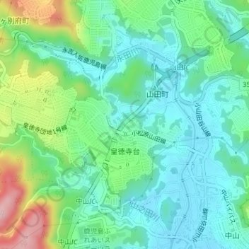
Name: 皇徳寺台 topographic map, elevation, terrain.
Location: 皇徳寺台, 鹿児島市, 鹿児島県, 892-8677, 日本 (31.55456 130.47598 31.56886 130.50116)
Average elevation: 66 m
Minimum elevation: 6 m
Maximum elevation: 223 m
Other topographic maps
Click on a map to view its topography, its elevation and its terrain.