
春山町 topographic map
Interactive map
Click on the map to display elevation.
About this map
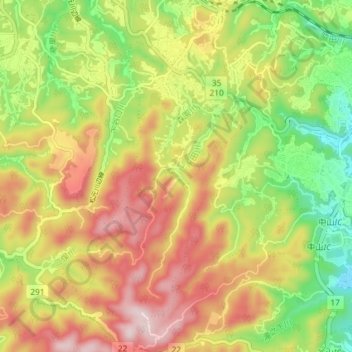
Name: 春山町 topographic map, elevation, terrain.
Location: 春山町, 鹿児島市, 鹿児島県, 892-8677, 日本 (31.53048 130.43544 31.59254 130.47126)
Average elevation: 191 m
Minimum elevation: 7 m
Maximum elevation: 381 m
Other topographic maps
Click on a map to view its topography, its elevation and its terrain.