
上本町 topographic map
Interactive map
Click on the map to display elevation.
About this map
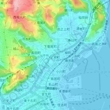
Name: 上本町 topographic map, elevation, terrain.
Location: 上本町, 鹿児島市, 鹿児島県, 892-8677, 日本 (31.60132 130.55832 31.60353 130.56305)
Average elevation: 31 m
Minimum elevation: -1 m
Maximum elevation: 144 m
Other topographic maps
Click on a map to view its topography, its elevation and its terrain.