
石谷町 topographic map
Interactive map
Click on the map to display elevation.
About this map
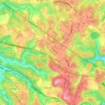
Name: 石谷町 topographic map, elevation, terrain.
Location: 石谷町, 鹿児島市, 鹿児島県, 892-8677, 日本 (31.59155 130.42791 31.63073 130.47181)
Average elevation: 158 m
Minimum elevation: 72 m
Maximum elevation: 222 m
Other topographic maps
Click on a map to view its topography, its elevation and its terrain.