
高塚山 topographic map
Interactive map
Click on the map to display elevation.
About this map
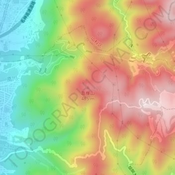
Name: 高塚山 topographic map, elevation, terrain.
Location: 高塚山, 京都市, 京都府, 607-8175, 日本 (34.96028 135.83702 34.96038 135.83712)
Average elevation: 291 m
Minimum elevation: 42 m
Maximum elevation: 534 m
Other topographic maps
Click on a map to view its topography, its elevation and its terrain.