
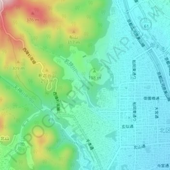
尺八池 topographic map
Interactive map
Click on the map to display elevation.
About this map
Name: 尺八池 topographic map, elevation, terrain.
Location: 尺八池, 大宮薬師山西町, 北区, 京都市, 京都府, 日本 (35.05824 135.73374 35.05990 135.73483)
Average elevation: 168 m
Minimum elevation: 79 m
Maximum elevation: 410 m
Other topographic maps
Click on a map to view its topography, its elevation and its terrain.