
観音山 topographic map
Interactive map
Click on the map to display elevation.
About this map
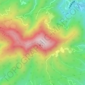
Name: 観音山 topographic map, elevation, terrain.
Location: 観音山, 浜松市, 静岡県, 中部地方, 日本 (34.90002 137.74448 34.90012 137.74458)
Average elevation: 298 m
Minimum elevation: 78 m
Maximum elevation: 566 m
Other topographic maps
Click on a map to view its topography, its elevation and its terrain.