
佐鳴湖 topographic map
Interactive map
Click on the map to display elevation.
About this map
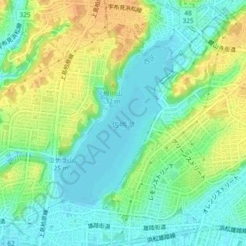
Name: 佐鳴湖 topographic map, elevation, terrain.
Location: 佐鳴湖, 浜松市, 静岡県, 日本 (34.70275 137.68148 34.72063 137.69852)
Average elevation: 16 m
Minimum elevation: 0 m
Maximum elevation: 39 m
Other topographic maps
Click on a map to view its topography, its elevation and its terrain.