
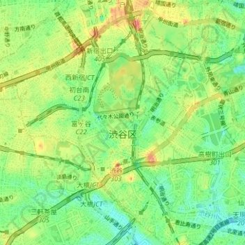
渋谷区 topographic map
Interactive map
Click on the map to display elevation.
About this map
Name: 渋谷区 topographic map, elevation, terrain.
Location: 渋谷区, 東京都, 日本 (35.64149 139.66138 35.69216 139.72393)
Average elevation: 36 m
Minimum elevation: 9 m
Maximum elevation: 75 m
Other topographic maps
Click on a map to view its topography, its elevation and its terrain.