
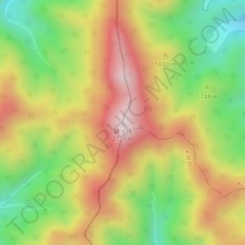
鎌ヶ峰 topographic map
Interactive map
Click on the map to display elevation.
About this map
Name: 鎌ヶ峰 topographic map, elevation, terrain.
Location: 鎌ヶ峰, 松本市, 長野県, 日本 (36.02654 137.59909 36.02664 137.59919)
Average elevation: 1,799 m
Minimum elevation: 1,502 m
Maximum elevation: 2,101 m
鎌ヶ峰(かまがみね)は、飛騨山脈乗鞍岳の南方にある長野県と岐阜県の境界にある標高2,121 mの山。
Other topographic maps
Click on a map to view its topography, its elevation and its terrain.