
女鳥羽川 topographic map
Interactive map
Click on the map to display elevation.
About this map
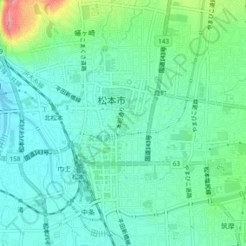
Name: 女鳥羽川 topographic map, elevation, terrain.
Location: 女鳥羽川, 葭町, 松本市, 長野県, 〒390-0811, 日本 (36.23261 137.96020 36.23858 137.97901)
Average elevation: 598 m
Minimum elevation: 575 m
Maximum elevation: 667 m
Other topographic maps
Click on a map to view its topography, its elevation and its terrain.