
王ヶ頭 topographic map
Interactive map
Click on the map to display elevation.
About this map
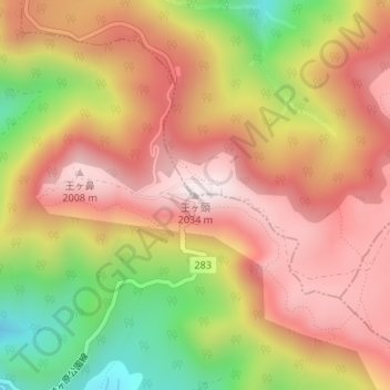
Name: 王ヶ頭 topographic map, elevation, terrain.
Location: 王ヶ頭, 松本市, 長野県, 386-0507, 日本 (36.22578 138.10739 36.22588 138.10749)
Average elevation: 1,782 m
Minimum elevation: 1,417 m
Maximum elevation: 2,035 m
Other topographic maps
Click on a map to view its topography, its elevation and its terrain.