
霞沢岳 topographic map
Interactive map
Click on the map to display elevation.
About this map
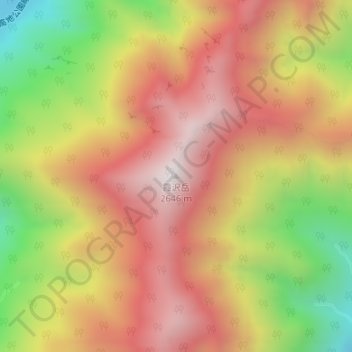
Name: 霞沢岳 topographic map, elevation, terrain.
Location: 霞沢岳, 松本市, 長野県, 日本 (36.22118 137.64054 36.22128 137.64064)
Average elevation: 2,141 m
Minimum elevation: 1,498 m
Maximum elevation: 2,632 m
霞沢岳(かすみざわだけ)は、飛騨山脈(北アルプス)南部に位置する標高は2,646 mの山。山体すべてが長野県松本市に属する。
Other topographic maps
Click on a map to view its topography, its elevation and its terrain.