
河原 topographic map
Interactive map
Click on the map to display elevation.
About this map
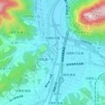
Name: 河原 topographic map, elevation, terrain.
Location: 河原, 下渡一木, 鳥取市, 鳥取県, 680-1221, 日本 (35.39285 134.19196 35.41285 134.21196)
Average elevation: 73 m
Minimum elevation: 14 m
Maximum elevation: 318 m
Other topographic maps
Click on a map to view its topography, its elevation and its terrain.