
勝見川 topographic map
Interactive map
Click on the map to display elevation.
About this map
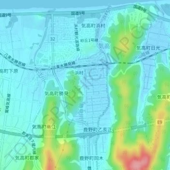
Name: 勝見川 topographic map, elevation, terrain.
Location: 勝見川, 勝見, 気高, 鳥取市, 鳥取県, 689-0399, 日本 (35.50373 134.05186 35.50918 134.05218)
Average elevation: 21 m
Minimum elevation: -5 m
Maximum elevation: 115 m
Other topographic maps
Click on a map to view its topography, its elevation and its terrain.