
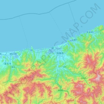
猫島 topographic map
Interactive map
Click on the map to display elevation.
About this map
Name: 猫島 topographic map, elevation, terrain.
Location: 猫島, 鳥取市, 鳥取県, 689-0203, 日本 (35.18003 133.84034 35.82003 134.48034)
Average elevation: 271 m
Minimum elevation: -4 m
Maximum elevation: 1,493 m
Other topographic maps
Click on a map to view its topography, its elevation and its terrain.