
一里松 topographic map
Interactive map
Click on the map to display elevation.
About this map
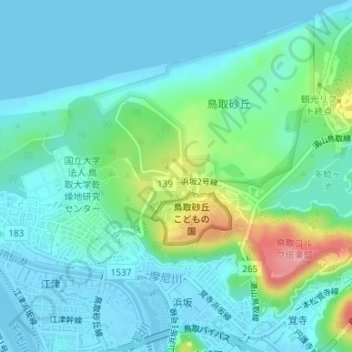
Name: 一里松 topographic map, elevation, terrain.
Location: 一里松, 浜坂2号線, 浜坂三丁目, 鳥取市, 鳥取県, 680-0001, 日本 (35.53563 134.22270 35.53573 134.22280)
Average elevation: 24 m
Minimum elevation: -4 m
Maximum elevation: 114 m
Other topographic maps
Click on a map to view its topography, its elevation and its terrain.