
殿ダム topographic map
Interactive map
Click on the map to display elevation.
About this map
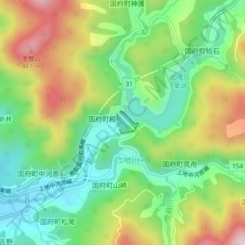
Name: 殿ダム topographic map, elevation, terrain.
Location: 殿ダム, 国府町山崎, 鳥取市, 鳥取県, 日本 (35.44789 134.34033 35.45014 134.34313)
Average elevation: 253 m
Minimum elevation: 108 m
Maximum elevation: 476 m
Other topographic maps
Click on a map to view its topography, its elevation and its terrain.