
佐治川ダム topographic map
Interactive map
Click on the map to display elevation.
About this map
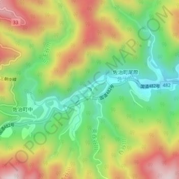
Name: 佐治川ダム topographic map, elevation, terrain.
Location: 佐治川ダム, 佐治町尾際, 鳥取市, 鳥取県, 日本 (35.32903 134.04323 35.32953 134.04385)
Average elevation: 553 m
Minimum elevation: 324 m
Maximum elevation: 843 m
Other topographic maps
Click on a map to view its topography, its elevation and its terrain.