
井口公園 topographic map
Interactive map
Click on the map to display elevation.
About this map
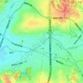
Name: 井口公園 topographic map, elevation, terrain.
Location: 井口公園, 井口二丁目, 天白区, 名古屋市, 愛知県, 中部地方, 日本 (35.12794 136.99613 35.12866 136.99718)
Average elevation: 35 m
Minimum elevation: 13 m
Maximum elevation: 71 m
Other topographic maps
Click on a map to view its topography, its elevation and its terrain.