
南区 topographic map
Interactive map
Click on the map to display elevation.
About this map
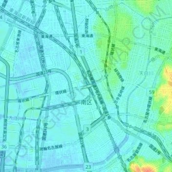
Name: 南区 topographic map, elevation, terrain.
Location: 南区, 名古屋市, 愛知県, 日本 (35.06841 136.90045 35.11819 136.94957)
Average elevation: 6 m
Minimum elevation: -3 m
Maximum elevation: 41 m
国道1号を境に、東側は笠寺台地とよばれる丘陵地。西側は山崎川および天白川に沿った平坦な地形で、海抜ゼロメートル地帯が多い。
Other topographic maps
Click on a map to view its topography, its elevation and its terrain.