
港区 topographic map
Interactive map
Click on the map to display elevation.
About this map
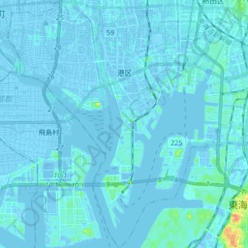
Name: 港区 topographic map, elevation, terrain.
Location: 港区, 名古屋市, 愛知県, 日本 (35.02595 136.79197 35.12706 136.91215)
Average elevation: 1 m
Minimum elevation: -14 m
Maximum elevation: 35 m
Other topographic maps
Click on a map to view its topography, its elevation and its terrain.