
若草山 topographic map
Interactive map
Click on the map to display elevation.
About this map
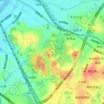
Name: 若草山 topographic map, elevation, terrain.
Location: 若草山, 名古屋市, 愛知県, 458-0833, 日本 (35.06507 136.95506 35.06517 136.95516)
Average elevation: 22 m
Minimum elevation: -1 m
Maximum elevation: 55 m
Other topographic maps
Click on a map to view its topography, its elevation and its terrain.