
権現岳 topographic map
Interactive map
Click on the map to display elevation.
About this map
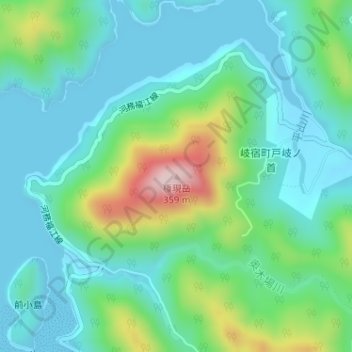
Name: 権現岳 topographic map, elevation, terrain.
Location: 権現岳, 五島市, 長崎県, 853-0054, 日本 (32.75040 128.78699 32.75050 128.78709)
Average elevation: 81 m
Minimum elevation: 0 m
Maximum elevation: 336 m
Other topographic maps
Click on a map to view its topography, its elevation and its terrain.