
鷲ヶ岳 topographic map
Interactive map
Click on the map to display elevation.
About this map
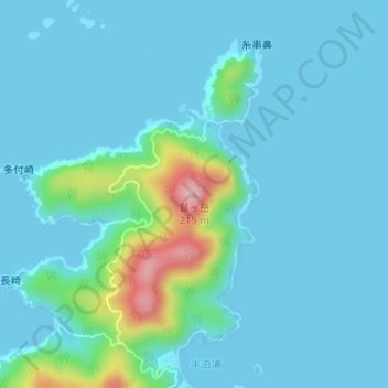
Name: 鷲ヶ岳 topographic map, elevation, terrain.
Location: 鷲ヶ岳, 五島市, 長崎県, 853-0054, 日本 (32.78741 128.80524 32.78751 128.80534)
Average elevation: 26 m
Minimum elevation: 0 m
Maximum elevation: 192 m
Other topographic maps
Click on a map to view its topography, its elevation and its terrain.