
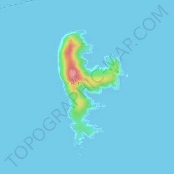
蠑螺島 topographic map
Interactive map
Click on the map to display elevation.
About this map
Name: 蠑螺島 topographic map, elevation, terrain.
Location: 蠑螺島, 五島市, 長崎県, 日本 (32.69399 128.89347 32.71188 128.90580)
Average elevation: 5 m
Minimum elevation: 0 m
Maximum elevation: 119 m
Other topographic maps
Click on a map to view its topography, its elevation and its terrain.