
ハナグリ島 topographic map
Interactive map
Click on the map to display elevation.
About this map
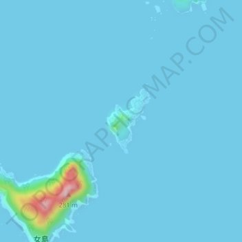
Name: ハナグリ島 topographic map, elevation, terrain.
Location: ハナグリ島, 五島市, 長崎県, 日本 (32.00790 128.35950 32.01515 128.36531)
Average elevation: 10 m
Minimum elevation: 0 m
Maximum elevation: 252 m
Other topographic maps
Click on a map to view its topography, its elevation and its terrain.