
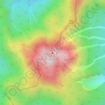
焼岳 topographic map
Interactive map
Click on the map to display elevation.
About this map
Name: 焼岳 topographic map, elevation, terrain.
Location: 焼岳, 高山市, 岐阜県, 日本 (36.22884 137.58819 36.22894 137.58829)
Average elevation: 1,962 m
Minimum elevation: 1,585 m
Maximum elevation: 2,451 m
Other topographic maps
Click on a map to view its topography, its elevation and its terrain.