
涸沢岳 topographic map
Interactive map
Click on the map to display elevation.
About this map
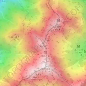
Name: 涸沢岳 topographic map, elevation, terrain.
Location: 涸沢岳, 高山市, 岐阜県, 日本 (36.29653 137.64666 36.29663 137.64676)
Average elevation: 2,642 m
Minimum elevation: 1,784 m
Maximum elevation: 3,185 m
Other topographic maps
Click on a map to view its topography, its elevation and its terrain.