
錫杖岳 topographic map
Interactive map
Click on the map to display elevation.
About this map
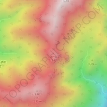
Name: 錫杖岳 topographic map, elevation, terrain.
Location: 錫杖岳, 高山市, 岐阜県, 506-1421, 日本 (36.28187 137.54717 36.28197 137.54727)
Average elevation: 1,834 m
Minimum elevation: 1,095 m
Maximum elevation: 2,310 m
Other topographic maps
Click on a map to view its topography, its elevation and its terrain.