
平湯温泉 topographic map
Interactive map
Click on the map to display elevation.
About this map
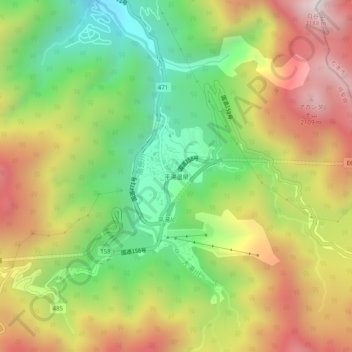
Name: 平湯温泉 topographic map, elevation, terrain.
Location: 平湯温泉, 高山市, 岐阜県, 506-1433, 日本 (36.17149 137.53367 36.21149 137.57367)
Average elevation: 1,568 m
Minimum elevation: 1,049 m
Maximum elevation: 2,164 m
Other topographic maps
Click on a map to view its topography, its elevation and its terrain.