
アカンダナ山 topographic map
Interactive map
Click on the map to display elevation.
About this map
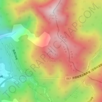
Name: アカンダナ山 topographic map, elevation, terrain.
Location: アカンダナ山, 高山市, 岐阜県, 〒506-1432, 日本 (36.20023 137.57261 36.20033 137.57271)
Average elevation: 1,726 m
Minimum elevation: 1,238 m
Maximum elevation: 2,164 m
アカンダナ山(アカンダナやま)は、岐阜県高山市(旧上宝村)、飛驒山脈南部にある標高2,109 mの活火山である。
Other topographic maps
Click on a map to view its topography, its elevation and its terrain.