
Nagakute topographic map
Interactive map
Click on the map to display elevation.
Nagakute
Nagakute is located in the Owari Hills of central Aichi Prefecture, at an elevation of 43 to 184 meters, and is bordered by the metropolis of Nagoya to the west. Thirteen rivers flow through the city.
About this map
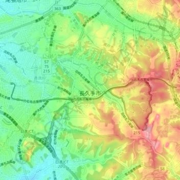
Name: Nagakute topographic map, elevation, terrain.
Location: Nagakute, Aichi Prefecture, Japan (35.15472 137.01792 35.19589 137.09759)
Average elevation: 99 m
Minimum elevation: 41 m
Maximum elevation: 186 m
Other topographic maps
Click on a map to view its topography, its elevation and its terrain.
Mt. Kumotori
Mount Kumotori (雲取山, Kumotori-san) stands at the boundary of Tokyo, Saitama, and Yamanashi Prefectures on the island of Honshū, Japan. With an elevation of 2,017 metres (6,617 ft), its summit is the highest point in Tokyo. It separates the Okutama Mountains and the Okuchichibu Mountains. While it marks…
Average elevation: 1,625 m