
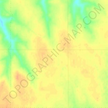
United States topographic map
Interactive map
Click on the map to display elevation.
About this map
Name: United States topographic map, elevation, terrain.
Location: United States (-14.76084 -180.00000 71.58895 180.00000)
Average elevation: 309 m
Minimum elevation: -29 m
Maximum elevation: 5,001 m
The Rocky Mountains, west of the Great Plains, extend north to south across the country, peaking at over 14,000 feet (4,300 m) in Colorado. Farther west are the rocky Great Basin and deserts such as the Chihuahua, Sonoran, and Mojave. The Sierra Nevada and Cascade mountain ranges run close to the Pacific coast, both ranges also reaching altitudes higher than 14,000 feet (4,300 m). The lowest and highest points in the contiguous United States are in the state of California, and only about 84 miles (135 km) apart. At an elevation of 20,310 feet (6,190.5 m), Alaska's Denali is the highest peak in the country and in North America. Active volcanoes are common throughout Alaska's Alexander and Aleutian Islands, and Hawaii consists of volcanic islands. The supervolcano underlying Yellowstone National Park in the Rockies is the continent's largest volcanic feature.
Other topographic maps
Click on a map to view its topography, its elevation and its terrain.
India
India
Average elevation: 1,017 m
Hyderabad
India > Telangana > Bahadurpura mandal
Hyderabad, Bahadurpura mandal, Hyderabad District, Telangana, India
Average elevation: 549 m
Sri Lanka
Sri Lanka
Average elevation: 50 m
Montreal
Canada > Quebec > Urban agglomeration of Montreal > Montreal
Montreal, Urban agglomeration of Montreal, Montreal (06), Quebec, H3B 1M7, Canada
Average elevation: 30 m
Nepal
Nepal
Average elevation: 2,604 m
Snohomish County
Snohomish County, Washington, United States
Average elevation: 649 m
Dehradun
India > Uttarakhand > Dehradun
Dehradun, Dehradun District, Uttarakhand, 248001, India
Average elevation: 904 m
Kandy
Kandy, Kandy District, Central Province, 20000, Sri Lanka
Average elevation: 621 m
Ocheretyne
Ocheretyne, Ocheretyne settlement hromada, Pokrovskii Raion, Donetsk Oblast, 86020, Ukraine
Average elevation: 227 m
Surat
India > Gujarat > Katargam Taluka > Surat
Surat, Katargam Taluka, Surat, Gujarat, 395001, India
Average elevation: 11 m
Madurai
India > Tamil Nadu > Madurai
Madurai, Madurai South, Madurai district, Tamil Nadu, India
Average elevation: 138 m
Mambakkam
India > Tamil Nadu > Tiruporur
Mambakkam, Tiruporur, Chengalpattu District, Tamil Nadu, 600127, India
Average elevation: 16 m
A`zaz
A`zaz, Azaz Subdistrict, Azaz District, Aleppo Governorate, Syria
Average elevation: 559 m
Haywood County
United States > North Carolina
Haywood County, North Carolina, United States
Average elevation: 1,044 m
Copenhagen
Denmark > Capital Region of Denmark
Copenhagen, Copenhagen Municipality, Capital Region of Denmark, 1357, Denmark
Average elevation: 9 m
Bengaluru
India > Karnataka > Bangalore North
Bengaluru, Bangalore North, Bengaluru Urban District, Karnataka, India
Average elevation: 881 m
Noida
India > Uttar Pradesh > Dadri
Noida, Dadri, Gautam Buddha Nagar District, Uttar Pradesh, 201301, India
Average elevation: 216 m
Tigawan
India > Madhya Pradesh > Panna Tahsil > Tilguwan
Tigawan, Tilguwan, Panna Tahsil, Panna District, Madhya Pradesh, India
Average elevation: 407 m
Sierra Vista Open Space Preserve
United States > California > Santa Clara County > San Jose
Sierra Vista Open Space Preserve, San Jose, Santa Clara County, California, United States
Average elevation: 484 m
Ooty Lake
India > Tamil Nadu > Udhagamandalam > Udhagamandalam
Ooty Lake, Udhagamandalam, The Nilgiris District, Tamil Nadu, 643001, India
Average elevation: 2,235 m
Chasiv Yar
Chasiv Yar, Chasiv Yar urban hromada, Bakhmut Raion, Donetsk Oblast, 84551-84556, Ukraine
Average elevation: 213 m
Mangaluru
India > Karnataka > Mangaluru taluk
Mangaluru, Mangaluru taluk, Dakshina Kannada District, Karnataka, 575001, India
Average elevation: 25 m
Pune
India > Maharashtra > Pune City > Pune
Pune, Pune City, Pune District, Maharashtra, 411001, India
Average elevation: 641 m
Kovilanchery
India > Tamil Nadu > Tambaram
Kovilanchery, Tambaram, Chengalpattu District, Tamil Nadu, 600126, India
Average elevation: 11 m
Tacoma
United States > Washington > Pierce County
Tacoma, Pierce County, Washington, United States
Average elevation: 67 m
Hays County
United States of America > Texas
Hays County, Texas, United States of America
Average elevation: 285 m
Haraluru
India > Karnataka > Tumkur taluk
Haraluru, Tumkur taluk, Tumakuru District, Karnataka, India
Average elevation: 864 m
Ruang
Indonesia > North Sulawesi > Kepulauan Siau Tagulandang Biaro > Pumpente
Ruang, Pumpente, Kepulauan Siau Tagulandang Biaro, North Sulawesi, Sulawesi, Indonesia
Average elevation: 274 m