
中山川ダム topographic map
Interactive map
Click on the map to display elevation.
About this map
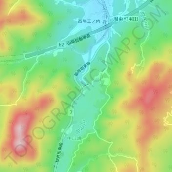
Name: 中山川ダム topographic map, elevation, terrain.
Location: 中山川ダム, 岩国市, 山口県, 日本 (34.05720 132.05199 34.05774 132.05303)
Average elevation: 156 m
Minimum elevation: 49 m
Maximum elevation: 312 m
Other topographic maps
Click on a map to view its topography, its elevation and its terrain.