
真珠湖 topographic map
Interactive map
Click on the map to display elevation.
About this map
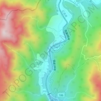
Name: 真珠湖 topographic map, elevation, terrain.
Location: 真珠湖, 岩国市, 山口県, 日本 (34.30805 132.12103 34.33093 132.12983)
Average elevation: 377 m
Minimum elevation: 187 m
Maximum elevation: 679 m
Other topographic maps
Click on a map to view its topography, its elevation and its terrain.