
大谷川 topographic map
Interactive map
Click on the map to display elevation.
About this map
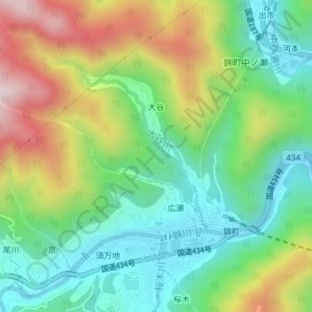
Name: 大谷川 topographic map, elevation, terrain.
Location: 大谷川, 大谷, 岩国市, 山口県, 740-0724, 日本 (34.26388 131.94790 34.27688 131.96030)
Average elevation: 269 m
Minimum elevation: 78 m
Maximum elevation: 596 m