
農鳥岳 topographic map
Interactive map
Click on the map to display elevation.
About this map
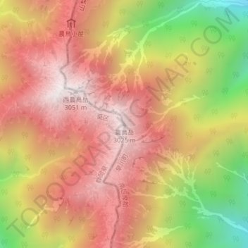
Name: 農鳥岳 topographic map, elevation, terrain.
Location: 農鳥岳, 早川町, 南巨摩郡, 山梨県, 日本 (35.62113 138.23681 35.62123 138.23691)
Average elevation: 2,559 m
Minimum elevation: 1,830 m
Maximum elevation: 3,039 m
農鳥岳(のうとりだけ)は南アルプス国立公園内の赤石山脈(南アルプス)にある標高3,026 mの山である。山頂は山梨県と静岡県の県境にまたがる。日本二百名山、新日本百名山、及び山梨百名山に選定されている。
Other topographic maps
Click on a map to view its topography, its elevation and its terrain.