
内川湖 topographic map
Interactive map
Click on the map to display elevation.
About this map
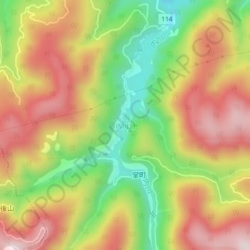
Name: 内川湖 topographic map, elevation, terrain.
Location: 内川湖, 金沢市, 石川県, 日本 (36.45245 136.66234 36.47335 136.67127)
Average elevation: 409 m
Minimum elevation: 174 m
Maximum elevation: 620 m
Other topographic maps
Click on a map to view its topography, its elevation and its terrain.