
卯辰山 topographic map
Interactive map
Click on the map to display elevation.
About this map
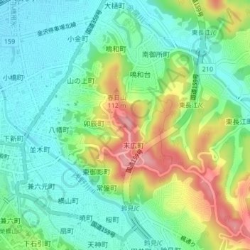
Name: 卯辰山 topographic map, elevation, terrain.
Location: 卯辰山, 金沢市, 石川県, 920-0926, 日本 (36.57314 136.67769 36.57324 136.67779)
Average elevation: 50 m
Minimum elevation: 8 m
Maximum elevation: 132 m
Other topographic maps
Click on a map to view its topography, its elevation and its terrain.