
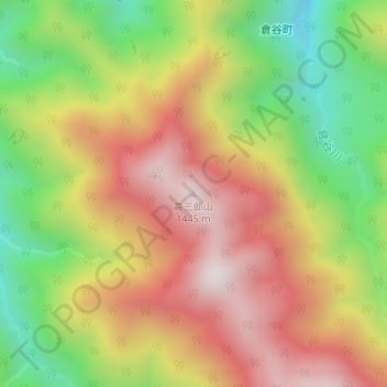
高三郎山 topographic map
Interactive map
Click on the map to display elevation.
About this map
Name: 高三郎山 topographic map, elevation, terrain.
Location: 高三郎山, 金沢市, 石川県, 日本 (36.37109 136.77358 36.37119 136.77368)
Average elevation: 1,018 m
Minimum elevation: 588 m
Maximum elevation: 1,420 m
国土地理院の掲載1:25000地形図は、『西赤尾』(にしあかお)である。国土地理院の三等三角点(「高三郎」と命名)が設けられている。
Other topographic maps
Click on a map to view its topography, its elevation and its terrain.